The bus stops in Bangsar are not uniformed — none of them look the same. The only similarity is that none of them have any information board, none whatsoever (I will provide photos after this post.)
Every bus stop should have:
(A) A signboard identifying the location of the bus stop
(B) A route map of every bus calling at the bus stop
(C) A real time info board that shows when the next bus is coming
(A) A signboard identifying the location of the bus stop
Every bus stop, even if it’s a pole, should have a clear signboard informing the public of the exact location of the bus stop (just like at every LRT station).
Even if the street has many bus stops, every bus stop should have a distinct name. For e.g., Jalan Telawi has 4 bus stops, therefore each bus stop should be named according to its exact location. For e.g:
1. Bangsar Village, Jalan Telawi,
2. Pos Malaysia, Jalan Telawi,
3. No. 47, Jalan Telawi, and
4. Junction of Jalan Terasek 8 & Jalan Telawi.
Below are examples of street names signboards on bus stops :
Bus Stop Pole in Winnipeg
This is how every bus pole should be:
(1) it’s multidirectional so the location (street name) of the bus stop can be seen from all four sides
(2) it’s very high therefore can be seen from a great distance and from inside a bus
(3) it has a real time display panel
(4) it has the bus number of every bus calling at the stop


Bus Shelter in New York City
[Please take note that I do not endorse glass roof for Malaysian bus shelter. Being under a glass roof in Malaysia is akin to an ant being under the magnifying glass under a hot sunny day.]


Love how the street names illuminate at night!
New York City even has a matching Bicycle Parking Space

Bus Shelter in Kansas City 

Check out the height and the size of the street name signpost!
Bus Shelter in Paris
Bus Shelter in Paris
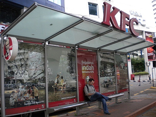
Bus shelter in Kuala Lumpur
It is evident that Parisign Sdn Bhd ripped off JCDecaux’s bus shelter in Paris but they didn’t bother to rip off the street name signboard attached to the rood of the shelter, instead they attached the brand name of the company advertising with them. I understand that Parisign is an advertising company therefore more concerned on getting maximum ad spac but DBKL should have regulate them better but yeah, never bet on DBKL to care for the welfare of KL residents.
The bus shelter in Paris might look industrial chic but it doesn’t provide ample shelter for commuters – the lady still needed to open up her umbrella to shelter herself from a light rain. Can you imagine how wet one would be under a heavy torrential rain?
Proposed Toronto Bus Shelter Design
I love the seamless and unobtrusive real time display panel; cleverly tucked at an angle, in between the roof and the wall. The street name,Queen St East, is decalled on the front and side glass panel of the shelter. 
Actual Toronto Bus Shelter
Street names are too small, IMO and no real time display panel.
Btw, I wonder if NY and Toronto feature a lot of glass in their bus shelter design to trap in the heat? It would be stupid of us to copy their design because our sun-rich tropical country needs public furnitures that dispel heat NOT trap heat!

Bus Shelter at Brentwood, London
Love the space saving real time display panel and how the street name does not take much space but yet clearly visible due to the backlight.
(B) A route map of every bus calling at the bus stop
The Bus Route Info on a Parisian Bus Stop tells you:
(1) where you are,
(2) where the bus is going and the route you are taking,
(3) where the bus came from,
(4) when the bus starts and ends its service on weekdays, weekends and public holiday (so you don’t have to waste your time waiting for the bus after its operating hours)
(5) the tariff zone, so you know how much you have to pay
(6) QR code to inform public bus users when the next bus is coming (it functions just like real time display panel but cheaper!)


There’s even one inside a Parisian bus!
(C) A real time info board that shows when the next bus is coming
We currently have real time info boards but not at every bus shelter. Below are examples from other countries.
Real Time Display Panel in a Bus Shelter in Sabimos, Netherlands
Real Time Display Panel in Winnipeg (attached to Bus Stop Pole)
Real Time Display Panel in Dublin

Note that the name of the street – Harrington Street – is written on the LED display board.
Real Time Display Panel in Hamburg

Note that the name of the Street – Rathausmarkt – is written above the display panel.

Real Time Display Panel in Portland Bus Shelter
Check out the fine print: Smoking is prohibited at TriMet shelters and stations
While we’re at it, get Real Time On Board Display Inside the Bus too!
Getting accurate information during the bus journey is just as important as getting real time bus information at the bus stop. It definitely makes riding the bus more accessible to tourists and even to locals who aren’t used to taking buses.
I don’t see why our buses can’t have this technology – our buses are already equipped with GPS and LCD Screens (which only screen advertisements, unfortunately).
Examples of Real Time On Board Display Inside the Bus:
Inside a bus in Munich
Inside a bus in Brussels 
Inside a tram in Zurich (I know a tram isn’t a bus but the real time on board technology is definitely transferable).
Inside a Skytrain in Bangkok
Take a look, the information was shown at the bottom of the screen while the advertisement played in the background. This way the company can still gain advertisement revenues and provide real time information at the same time. Genius!
If display panels are too expensive to feature at every bus stop, a QR code that can tell when the next bus is coming and the route maps for every bus that stops at the bus stop would suffice (not just at bus shelters but at every bus pole too!)


A QR code should also be able to tell commuters the bus route of a particular bus number. No point if you know when the bus is coming but do not know WHERE the bus is going!

The QR code should also be able tell Real Time Bus Information even when you are inside the bus! It is especially useful if you don’t remember or know the exact route.


Note: The pictures in this post (except for the one in Bangkok) were all sourced from the net.


